-

Eclipse solar total – Australia 2028
•
Le invitamos a unirse a nosotros en un viaje a Australia en julio de 2028 para contemplar uno de esos acontecimientos raros que permanecen en la memoria toda la vida: un eclipse total de Sol. Nuestro lugar de observación propuesto es Karlu Karlu, más conocido como Devils Marbles, en el…
-
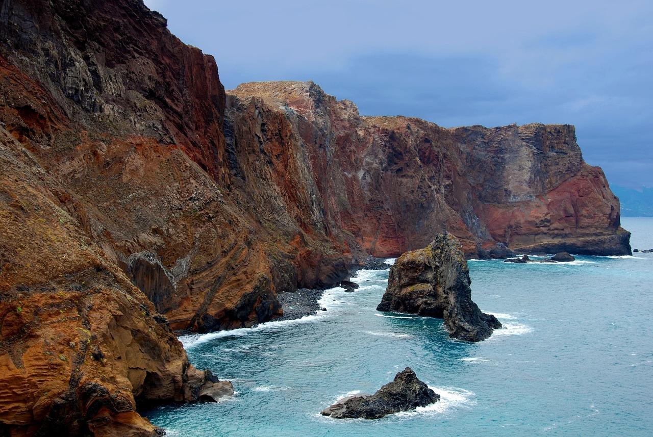
Eclipse solar anular – Madeira 2028
•
Le invitamos a seguir de cerca nuestros planes para un viaje especial a Madeira en enero de 2028, donde esperamos contemplar juntos un eclipse solar anular, uno de esos acontecimientos raros que permanecen en la memoria durante muchos años. Una isla que emerge del Atlántico, marcada por montañas, acantilados y…
-
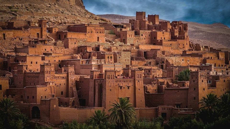
Eclipse solar total – Marruecos 2027
•
Le invitamos a unirse a nosotros en un viaje a Marruecos en 2027 para vivir uno de esos momentos raros que permanecen para siempre en la memoria: un eclipse total de Sol. Imagine la luz del desierto, los horizontes lejanos, los colores cálidos del sur y ese instante extraordinario en…
-

Eclipse solar visto desde Artemis II
•
Hay eclipses, y luego están los eclipses vistos desde el borde de la cuna de la Tierra. Desde Integrity, la nave espacial Orión de la misión Artemis, el drama familiar del Sol, la Luna y la sombra se transforma en algo mucho más profundo: una alineación silenciosa suspendida sobre la…
-
Eclipse solar total en Islandia 2026 – Plan de ruta 4×4 pág. 1
•
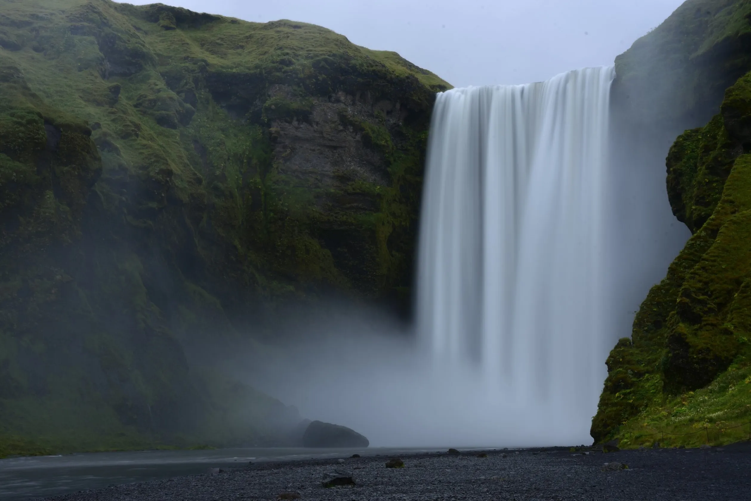
Islandia será uno de los mejores lugares del mundo para observar el eclipse solar total del 12 de agosto de 2026. Al estar situada dentro de la franja de totalidad, permitirá disfrutar de aproximadamente 1–2 minutos de oscuridad completa según la ubicación. La zona occidental del país destaca especialmente por…
-
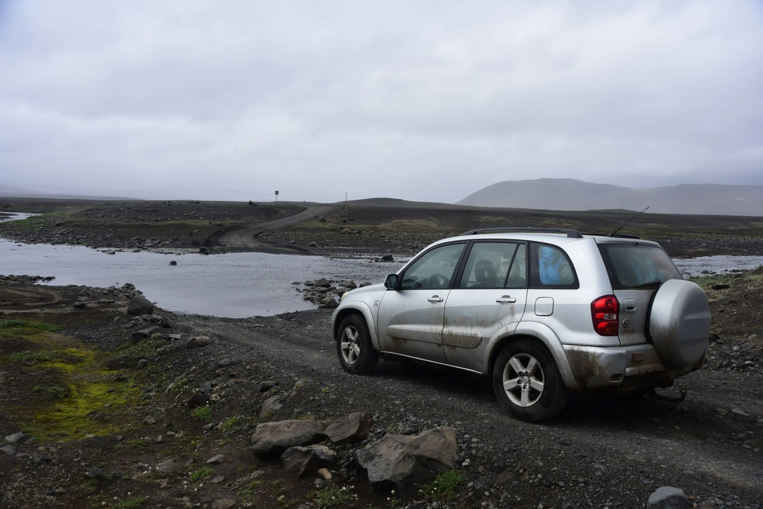
Eclipse solar total en Islandia 2026 – Plan de ruta 4×4 pág. 2
•
La segunda parte de la ruta en 4×4 se centra en la preparación final para observar el eclipse solar total del 12 de agosto de 2026. Es fundamental situarse dentro de la franja de totalidad, especialmente en el oeste de Islandia, incluyendo regiones como Westfjords, la península de Snæfellsnes y…
-
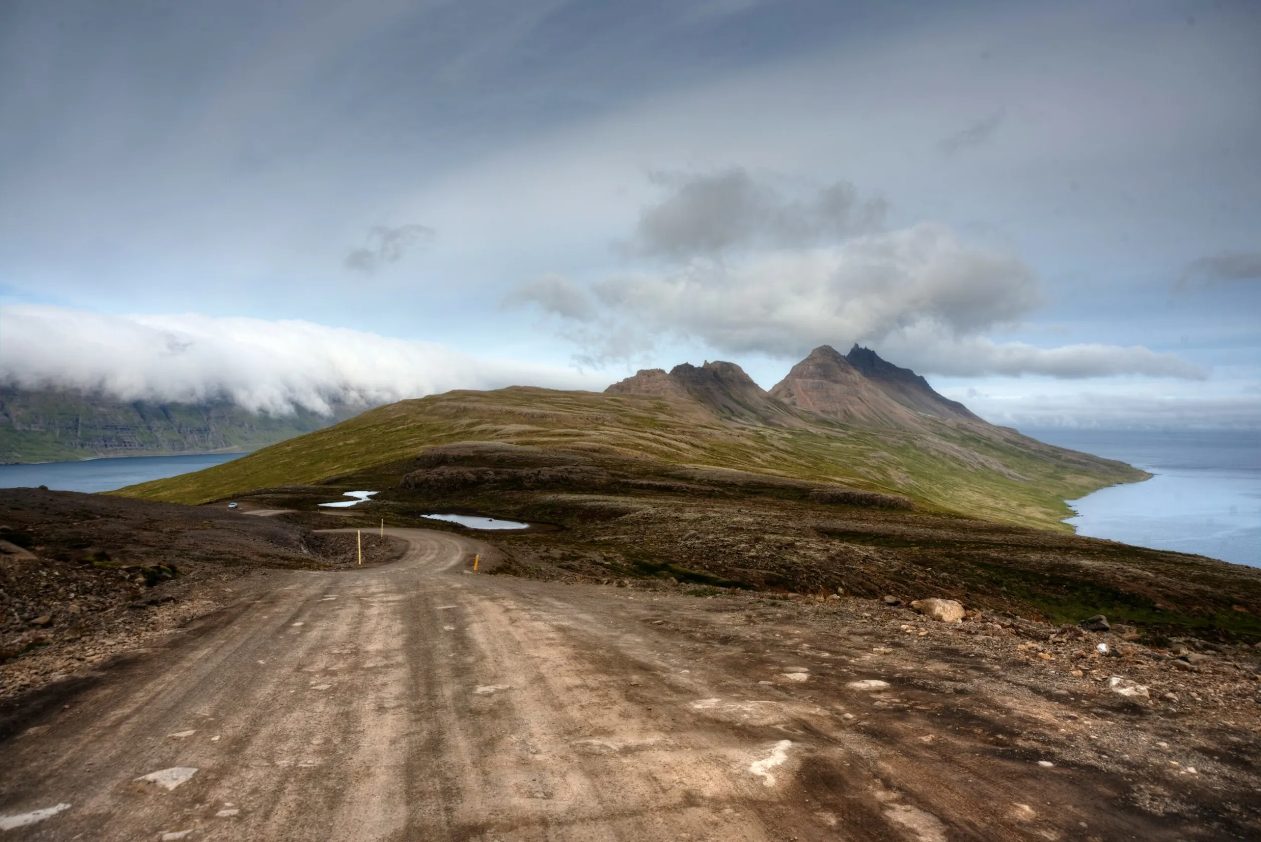
Eclipse solar total en Islandia 2026 – Plan de ruta camper pág.2
•
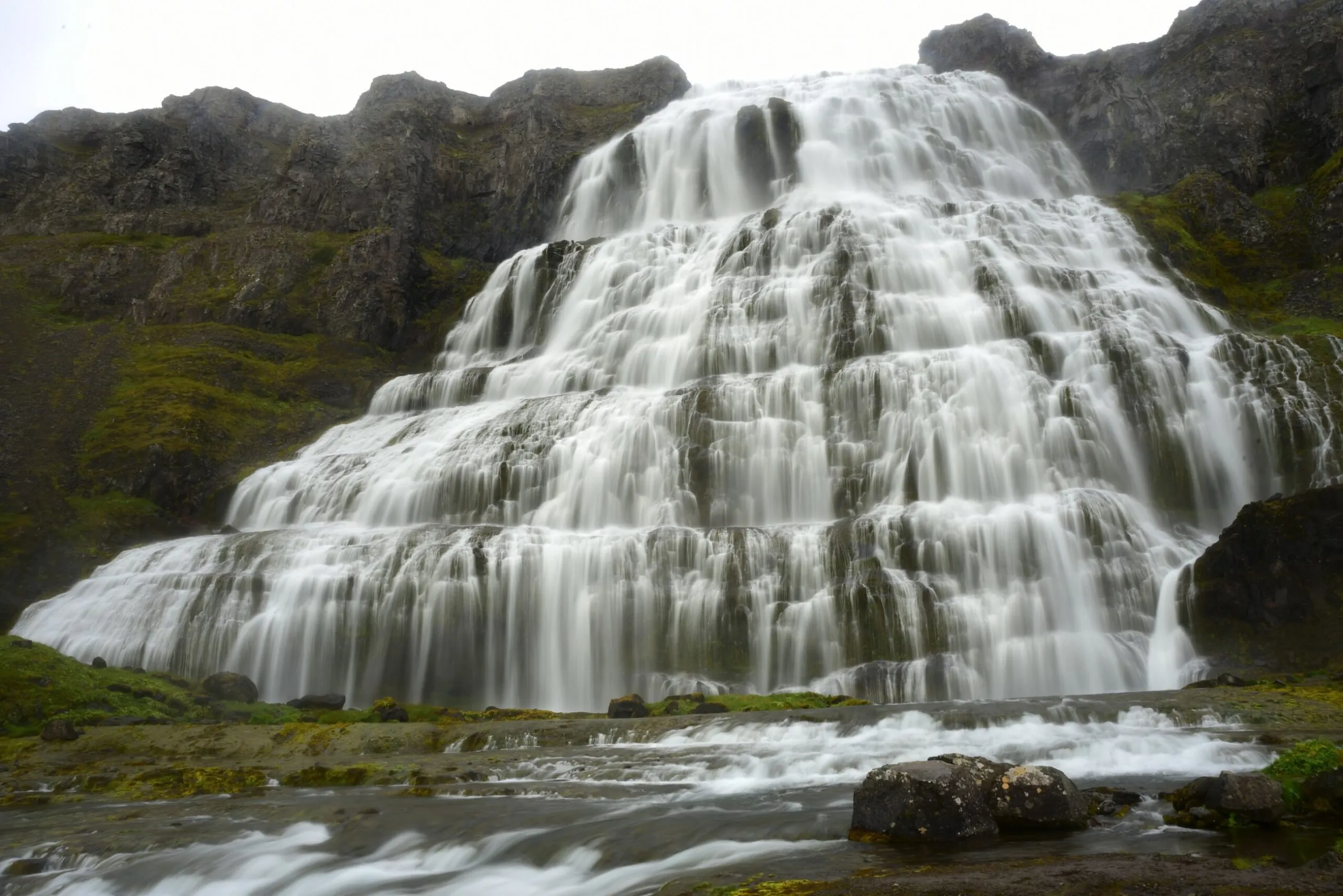
La segunda parte de nuestro viaje por Islandia nos lleva por el norte del país y hacia los Westfjords, donde la ruta se vuelve todavía más expedicionaria y los paisajes aún más salvajes. Empezamos cerca de Húsavík, con la posibilidad de observar ballenas por la mañana, y seguimos hacia las…
-
Eclipse solar total en Islandia 2026 – Plan de ruta camper pág. 1
•
Los primeros días de nuestra expedición islandesa en camper se sienten como una entrada directa al corazón de las fuerzas de la Tierra. Empezamos en la península de Reykjanes, donde la dorsal mesoatlántica emerge sobre el océano y el paisaje está marcado por grietas tectónicas, campos de lava, zonas geotérmicas…
-

Eclipse solar en Islandia – Expedición 2026
•
En agosto de 2026, el extremo occidental de Islandia será escenario de otro eclipse solar. Por ahora, esto es solo un avance, pero pronto publicaremos más información.
-
Baltic States Express
•
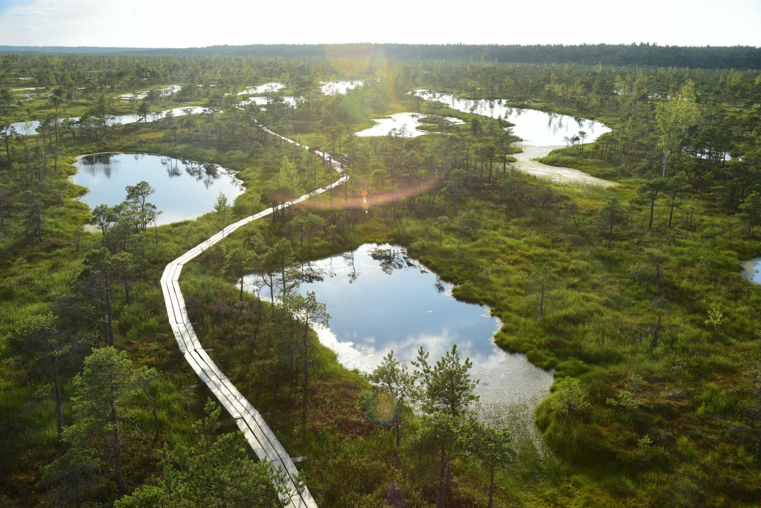
Baltic States Express es un viaje en varias etapas desde Gliwice a través de Lituania, Letonia y Estonia, combinando ciudades históricas, castillos, islas, parques nacionales, humedales y costas bálticas en una sola ruta llena de contrastes. Desde Trakai y Vilna, pasando por Aukštaitija, Riga, el valle del Gauja, Tartu, Soomaa…
Deja una respuesta